
Gathering Evidence for a Material Change of Use Application When considering a development application that requests a material change of use (MCU), most councils and government agencies require that you present a site plan showing, where appropriate, vegetation you wish to clear for the development. Some vegetation may be protected and it’s critical to establish prior to your application if protected vegetation species exist on the property and precisely where they are located, so you are not wasting expensive planning resources on locations that cannot be developed or require expensive planning permissions. Queensland Drones is a leading provider of aerial […]
tonygilbert
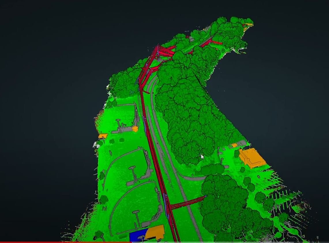
Precision Aerial Road Surveys
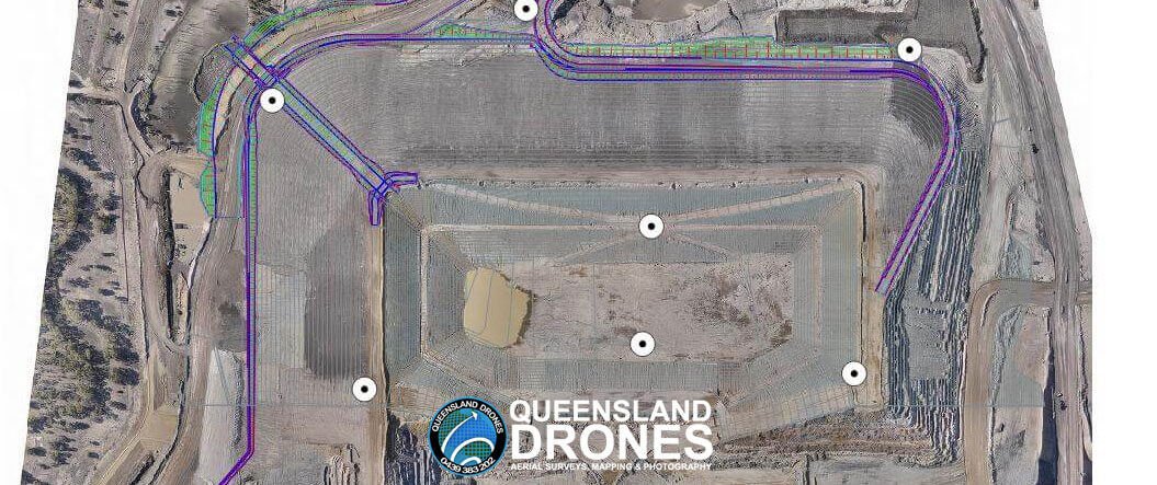
Drone Mapping for Councils and Government While the use of surveyors may be critical for some elements of road design and road redesign projects, the addition of precision UAV mapping can make the work of your surveyors much more timely, cost-effective and efficient. This is particularly true for councils and government authorities seeking disaster funding for road and bridge repairs, where the speed of the application process is often critical to the success of the funding application. Based on the Sunshine Coast, Queensland Drones specialises in precision mapping and modelling of road reserves and roads designated for reconstruction, even in […]
How Long Will We Keep Using Helicopter Surveys?
How many more manned aviation incidents do we need before we start to close the book on helicopter inspections and surveys?
How Much Does LIDAR Mapping Cost?
As a general rule, we advise our clients to budget for LIDAR mapping at $2500 per day. The actual cost may vary up and down a bit from there, but it’s a good rule of thumb to start considering affordability and value.
4 Top Reasons to Choose Drone Surveys
Drone surveys are still a relatively new and not fully understood process for many people, but professionals in the engineering, exploration, surveying and precision agriculture fields are rapidly embracing the advantages of this alternative approach to gathering critical site data. Where once they had to wait for a traditional surveyor to go out to a site, often spend several days there gathering ground-based measurements, then more days or even weeks compiling and presenting the data in a usable format, these early adopters are getting usable data in just a couple of days. Even traditional surveyors are increasingly embracing drone surveys […]
5 Tips for using a Drone for Gardening
Modernisation is seamlessly incorporated into our lives nowadays. We can learn anything with a simple video over the internet. We can socialise and provide professional services digitally. We can improve the quality of our lives by simply upgrading to more efficient technology. One of which is gardening. Gardening isn’t just about choosing the best fertiliser for the home garden or finding the best crops for greenhouses. It also involves the planning phase, which can be difficult without the right tools. A drone’s perspective provides many benefits for gardening, and we’ll show you a few tips in this article. Some purists […]
How accurate are drone mapping surveys?
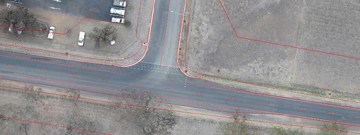
Can Drone Aerial Surveys Meet Engineering Standards? Drone mapping surveys are being used more and more to support construction, development, mining, agricultural and other commercial activities. Queensland Drones is a trusted provider of precision PPK Precision Aerial Mapping using purpose-built mapping UAVs. We regularly partner with engineers, surveyors and other industry professionals to rapidly deliver survey-grade aerial mapping (especially over larger areas). So how accurate are aerial mapping surveys using drones? And why does experience matter so much? It’s pretty easy to buy a drone and fly a site for mapping data. You can process it on an online platform […]
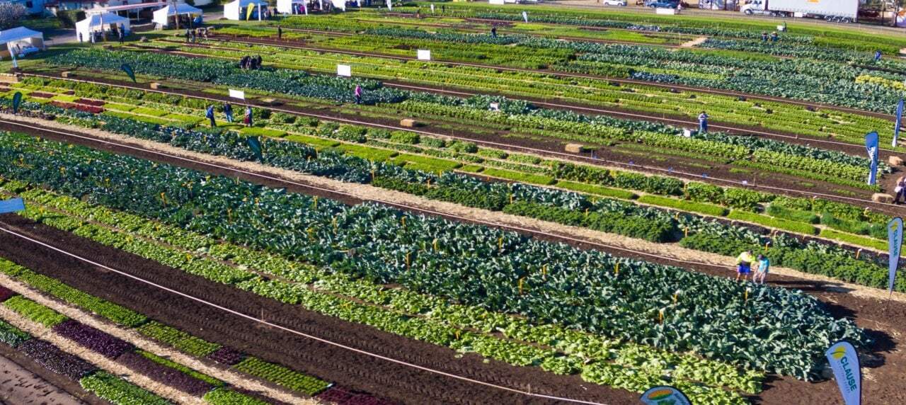
New Ways to Manage Seed Trials and Trial Plots in 4 Easy Steps
[smartslider3 slider=14] Improve Seed Trials using Multispectral Trial Plot Mapping Modern farming is challenging. Drought, climate change and other natural disasters are cutting farm profits, but you still need to do the best you can with what you have. Which is why seed selection and trial plots are so critical to the success of your crops. A recent survey by Farmers Business Network identified the biggest seed selection challenges facing farmers as: Needing to save money on inputs (23%) Not knowing how last year’s seeds performed before planting this year’s crops (22%) Pressure to make an early commitment to get […]
Aerial Photography Gallery
Here are a few aerial photos we’ve captured along our five year journey so far. Please let us know in the comments below what you think. [envira-gallery id=”9944″]
Aerial Landscape Gallery
Queensland Drones regularly provides landscape photography for property developers, rural and prestige real estate brokers, architects, building designers, tourism authorities and event managers. Here are some examples of our work. Click on any image to see it full size in the lightbox. Check out Drone Photography Services for more information about this service.
