
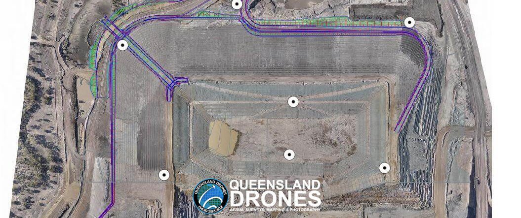
Can Drone Aerial Surveys Meet Engineering Standards? Drone mapping surveys are being used more and more to support construction, development, mining, agricultural and other commercial activities. Queensland Drones is a trusted provider of precision PPK Precision Aerial Mapping using purpose-built mapping UAVs. We regularly partner with engineers, surveyors and other industry professionals to rapidly deliver survey-grade aerial mapping (especially over larger areas). So how accurate are aerial mapping surveys using drones? And why does experience matter so much? It’s pretty easy to buy a drone and fly a site for mapping data. You can process it on an online platform […]
Year: 2020
New Ways to Manage Seed Trials and Trial Plots in 4 Easy Steps
[smartslider3 slider=14] Improve Seed Trials using Multispectral Trial Plot Mapping Modern farming is challenging. Drought, climate change and other natural disasters are cutting farm profits, but you still need to do the best you can with what you have. Which is why seed selection and trial plots are so critical to the success of your crops. A recent survey by Farmers Business Network identified the biggest seed selection challenges facing farmers as: Needing to save money on inputs (23%) Not knowing how last year’s seeds performed before planting this year’s crops (22%) Pressure to make an early commitment to get […]
Aerial Photography Gallery
Here are a few aerial photos we’ve captured along our five year journey so far. Please let us know in the comments below what you think. [envira-gallery id=”9944″]
Aerial Landscape Gallery
Queensland Drones regularly provides landscape photography for property developers, rural and prestige real estate brokers, architects, building designers, tourism authorities and event managers. Here are some examples of our work. Click on any image to see it full size in the lightbox. Check out Drone Photography Services for more information about this service.
What Is a Contour Survey?
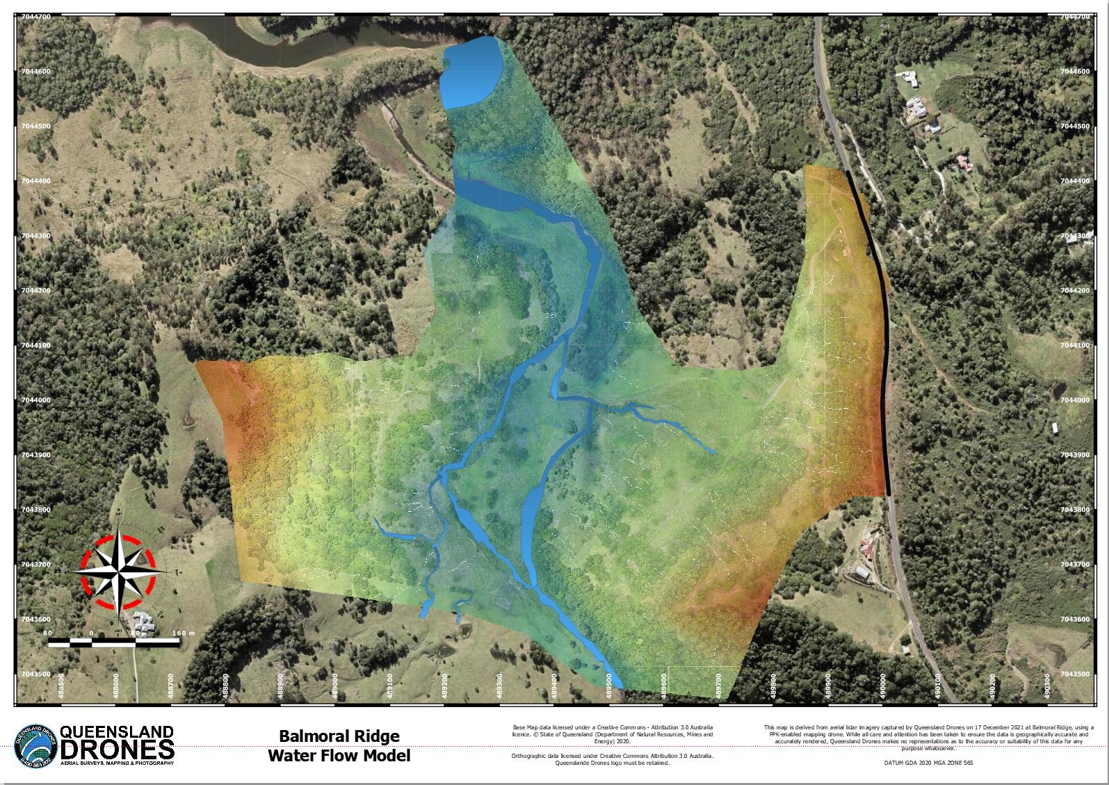
A contour survey is a way to easily visually understand the vertical and horizontal shape (the “topography”) of your land. By understanding the land contours, you can easily visualise or map how water will flow over the property when it rains, where it will collect, where it might erode the soil and many other important water flow characteristics, where to build access roads and how to farm your property along the contours. From this simple base, you can even develop water flow models, stream maps and determine the best places to create dams and silt traps. Do contour surveys need […]
Post Emergence Multispectral Crop Surveys
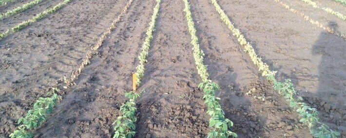
How to Rapidly Audit your Crop Planting Investment As identified by McCaine et al (University of Mississippi, 2019), “Plant density estimation during the emergence phase is critical for early-season decision making. Estimation of both crop and weed density is critical for addressing early season issues. Mapping of weeds in crops at any stage can be useful; however, early competition from weeds is frequently most detrimental to yield.” Planting new crops, especially in times of climate uncertainty, is a risky investment. It pays to make sure your new planting investment has produced the results you expected, and be able to take […]
Why Multispectral Mapping beats NDVI
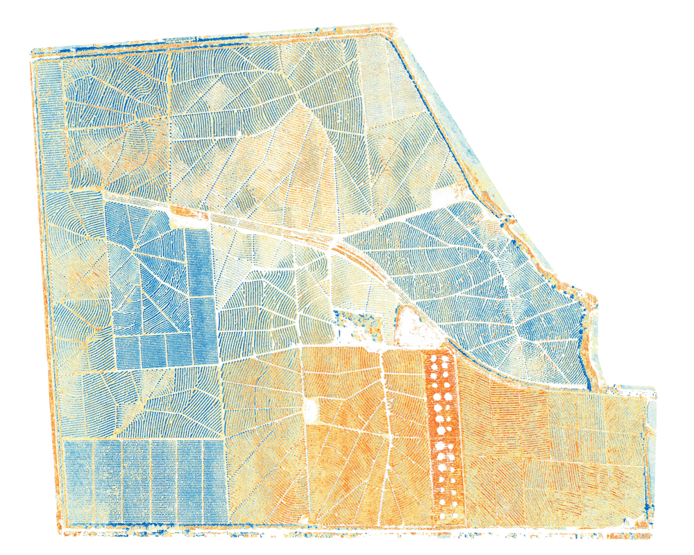
Getting the Right Management Insights at the Right Time Why is multispectral mapping so important? Because decision-making is not about pretty pictures, it’s about having the right data for the right job and empowering you to grow the healthiest crops you can. NDVI was good technology 30 years ago when the first Landsat satellites were launched, but there are so many more practical analysis options for Rededge Multispectral mapping data. It has even been shown that in some situations, using NDVI alone can result in false indications. Light conditions also affect how NDVI mapping is interpreted, which can also result […]
