Using NDVI to help manage a golf course
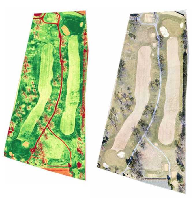
NDVI (Normalised Difference Vegetation Index) is nothing new in agriculture and has been widely used to detect crop health issues for many years. The idea of using NDVI imaging to manage turf health issues in golf courses is pretty new, although it is closely aligned with NDVI using in managing turf farms.
As with the adoption of NDVI imaging in agricultural sectors like horticulture and viticulture, adoption of this technology in golf course management is largely being driven by the needs of companies developing radical solutions to improve the quality of fairways and putting greens. These companies need proof that their products, ranging from seed varieties to worms, really do improve the health of turf on golf courses.
Along the way, these proof-of-concept NDVI surveys of golf course fairways and greens are identifying issues greenkeepers and course managers didn’t even know they had, like pest pressures and weed pressures, that had nothing at all to do with the products being tested but were about to become big management issues for the operators.
Because NDVI imaging measures how much infrared light is being reflected back from the turf, it can identify health issues long before they are visible to the naked eye (and often while there is still a good chance to correct them cost-effectively). This is because the green light we see reflected back from healthy turf is quite weak, in fact it can be 5-10 times less intense than the infrared light which healthy plants cannot use at all.
Why does it work?
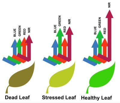
When plants start to absorb infrared light, the chlorophyll molecules in the plant begin to degrade and this in turn degrades the proteins in the leaf. Eventually these degradations will become visible to the naked eye as browning or leaf loss, but they’ve been visible to near-infrared imagery for some weeks already and could have been corrected long before they ever became visible.
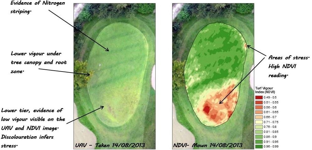
If the turf is uniformly healthy, the amounts of infrared light being reflected back from the turf will be fairly consisted and the NDVI index numbers will look much the same across the entire fairway or green in consistent sunlight. Variability in the NDVI indexes almost certainly indicates plant stresses that need to be investigated and ground-truthed.
Making it work for you
NDVI imaging doesn’t just identify weed and pest pressures. It can also pick out issues like turf dryness, turf hardness, waterlogging, persistent shading and fungal infestations that can affect turf vigour. It can even be used to identify areas where turf nutrition is weak or where irrigation and drainage issues are developing.
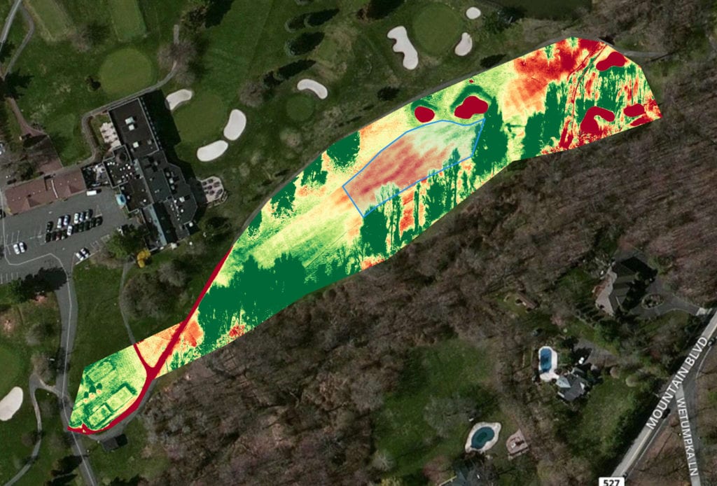
NDVI image mapping is not about making greenkeeping staff redundant, but it is a great tool to make their efforts more efficient and productive without making them work harder (just smarter). It can also save money for golf course operators through reduced application of fertilisers, herbicides, fungicides and pesticides by identifying “management zones” where more or less application is required (rather than uniformly applying chemicals across entire turf areas).
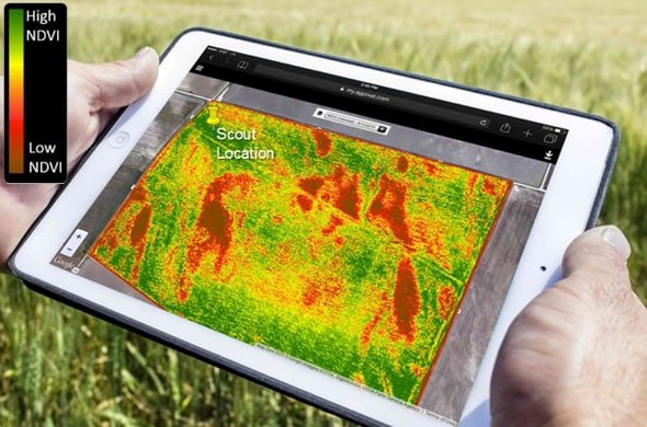
Because NDVI turf mapping is fully GPS-calibrated, the NDVI maps can be uploaded onto tablet devices and carried in the field to constantly show the operator’s location in respect of any turf management issues identified by the survey.
Queensland Drones offers both one-off golf course surveys and subscription services where we fly your fairways and greens once a week or once a month and provide access to a library of time-based data about the seasonal health patterns of your course. All data is yours to own and will not be shared without your permission. We can even supply your greenkeeping staff with NDVI-capable drone packages they can operate themselves, including full on-site training, if you’d prefer to have this data more often.
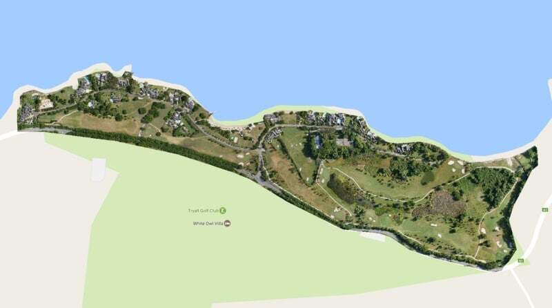
While we’re on-site to map the health of your fairways and greens, we can also map your entire golf course and provide a range of management and promotional outputs including fairway maps, preview videos, elevation maps, contour maps, even full 3D models of individual fairways or your entire course.
Get in touch with Queensland Drones
To find out how we can help you achieve your aerial photography, aerial video and aerial mapping needs, get in touch with us using the links below.
Request a Callback from Queensland Drones

Leave a Reply
You must be logged in to post a comment.