Aerial LIDAR Mapping and Survey Specialists
Aerial Mapping Solutions For Professionals
1
1
1
2

LIDAR, RGB, Thermal, Multispectral and More
1
1
1
2

From Urban Blocks to National Parks
1
1
1
2

Fully Processed, CAD-Ready Outputs
1
1
1
2

Professional Aerial Photography and Video
1
1
1
2

CASA-Certified, Fully Insured, Reliable and Fast
1
1
1
2

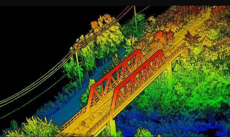
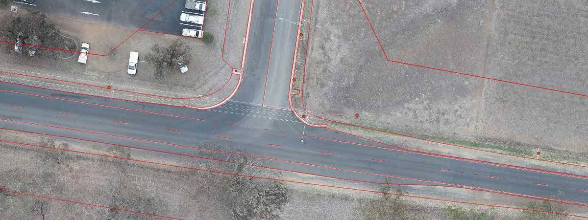
We provide our clients with fast, accurate, professional and state-of-the-art PPK aerial mapping services including LIDAR point clouds, TiN Mesh surface models, elevation contours, topographic maps, breakline and feature extraction, water flow projections and vegetation inspections and more.
We are based in Brisbane, Queensland, but operate regularly through Queensland, New South Wales and the Northern Territory. We also travel to other parts of Australia as required. We specialise in regional and remote area mapping and can currently hand projects up to 50,000 Ha (but our capabilities are improving all the time, so please ask us even if your project is larger than this).
If your project data is confidential or sensitive, please be assured that we do not use cloud-based processing platforms. All our processing is done manually by our own experienced GIS specialists, to ensure you receive the outputs you need, quality checked and ready to use in your preferred CAD and BIM platforms. We can even deliver outputs CAD-ready in AutoCAD Revit formats.
Our Commercial Drone Services
- Orthographic Mapping
-
LIDAR Mapping
- Thermal Mapping
- Multispectral Mapping
Our commercial drone services are constantly evolving and growing. They include:
- Aerial LIDAR Mapping
- PPK Precision Topographical Mapping
- Aerial Road and Corridor Surveys
- Construction and Development Surveys
- Environmental Mapping and Monitoring
- Aerial Asset and Infrastructure Inspections
- Mine and Quarry Mapping
- Multispectral Farm and Vegetation Mapping
- Large Farm and Property Infrastructure Mapping
Why You Should be Using Queensland Drones
“Tony was fantastic to deal with, very prompt, professional, and delivered high quality Lidar results quickly from a tricky area on a tight deadline. The fast delivery of results helped our project to move forward. Queensland Drones 5 star service.”
Siobhan Sweeney, Geology Manager, Cufe Ltd
- CASA Certified and Licensed
- $10 Million Public Liability Insurance
- $5 Million Professional Liability Insurance
- Comprehensive Job Safety Assessments
- Full PPE and Mine/Construction Spec Vehicles
- State of the Art Enterprise Drone Fleet
- Precision PPK GNSS Ground Controls
- In House Processing and GIS Capabilities
Drone Mapping and Drone Surveys
Queensland Drones specialises in drone mapping and drone surveys using state-of-the-art enterprise grade LIDAR sensors equipped with integrated photogrammetry cameras and PPK precision GNSS.
This means we can offer survey-grade aerial mapping products for use by registered surveyors, civil engineers and project managers, especially where we are working in close collaboration with traditional surveyors who can verify our base station and ground control point locations.
Aerial drone surveys leverage the outcomes of traditional survey methods as the data collected by the UAV LIDAR system can be meshed with data collected via ground surveys to quickly and accurately survey large areas without compromising survey precision or quality.
“Here will be a quote from a director of ONF Surveyors about working with Queensland Drones”
Jason Favier, Director, ONF Surveyors
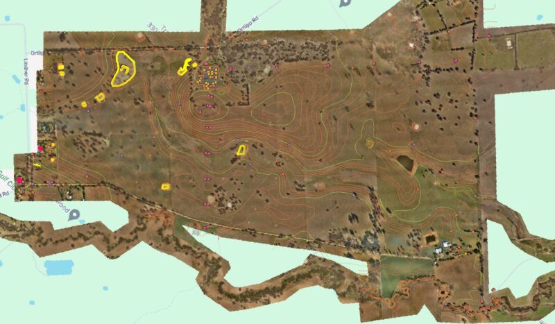
The example above shows a greenfield solar farm development site in New South Wales which was jointly surveyed by ONF Surveyors using traditional ground survey methods and Queensland Drones using precision drone LIDAR methods, which were integrated to produce a final survey map across a 660 Ha project site and incorporating almost 20km of associated waterways for flood impact mapping.
If you are developing a large area site for a renewable power project or other construction project, you need to consider how a precision aerial LIDAR survey, conducted in collaboration with your site surveyors, would improve your project outcomes and reduce pre-construction costs.
Or find out more about precision aerial mapping and aerial LIDAR surveying with Queensland Drones.
