Precision Farm Mapping using Drones
Detailed Farm Mapping for Large Properties
When your property is large, a long way from home, or scattered over multiple holdings, it can be hard to get the big picture of what you’re managing … and even harder to share that with others who you rely on your knowledge for their work.
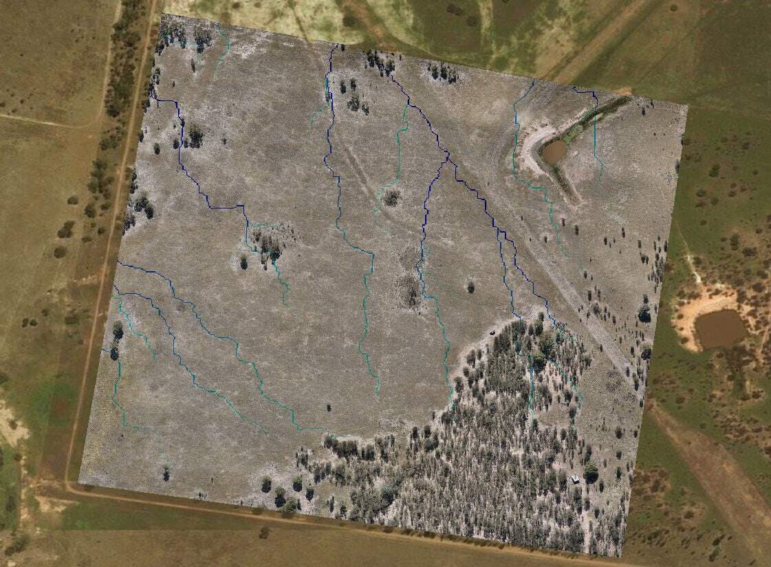
Our detailed farm mapping service uses purpose-designed fixed wing mapping drones to capture all of your property in amazing detail, and can be rendered in many different ways to meet your property management needs. It’s a flexible, powerful way to visualise larger properties.
Contact us now on 07 3103 0566 to discuss your needs, or request a quote.
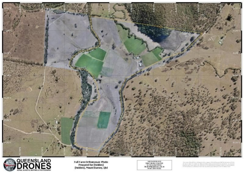
Printed and Laminated Farm Photos
Our most popular request is a large laminated wall print (A0 size – 841 x 1189mm) that you can draw on and share ideas, use as a workboard for planning changes and discussing challenges, or just admire what you’ve achieved.
Contact us now on 07 3103 0566 to discuss your needs, or request a quote.
Topographic Contour and Elevation Map
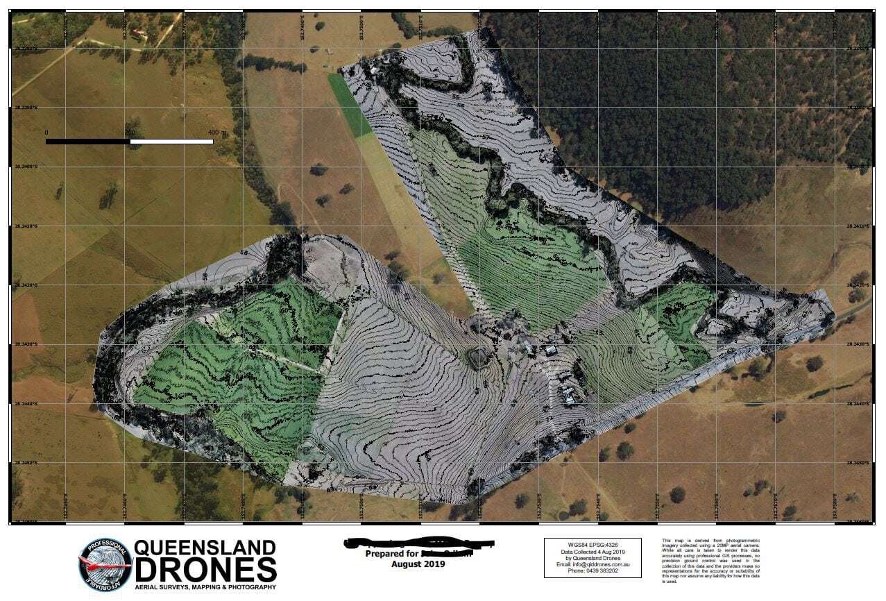
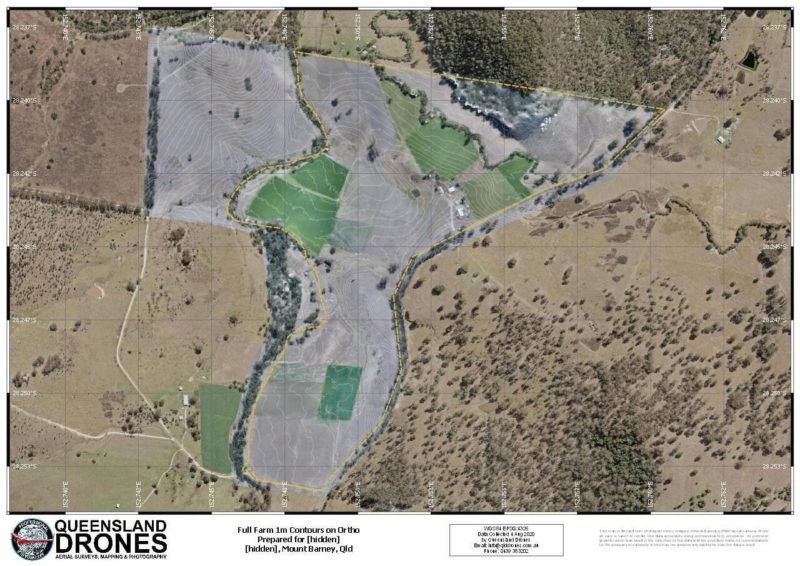
Our next most popular deliverable is a full farm topographic map. Forget 5m contour intervals from government maps, our topographic mapping can be rendered with contour intervals of 5m, 1m, 50cm, 25cm, even 10cm, depending on the terrain and how you need to use them.
Our aerial mapping data can be captured with a real world accuracy measured in centimetres (typically 3-5cm horizontal and 4-8cm vertical) using GIS-grade satellite measurement systems and precision ground control. For engineering or cadastral purposes, we can work with your preferred surveyor or we can partner with a surveyor for certification of results.
Contact us now on 07 3103 0566 to discuss your needs, or request a quote.
Some of our clients find it’s easier to visualise the terrain changes when they are overlaid onto a digital elevation model of the property, like the one below.
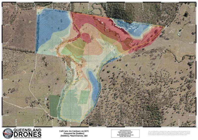
There are many other ways we can help you to visualise the terrain of your property, once we’ve captured and processed precision aerial mapping data.
Another popular visualisation of terrain changes is called “Hillshade”. It’s a rendering of the Digital Elevation Model that slightly exaggerates the high terrain using shadow so it can be more easily seen in the printed map.
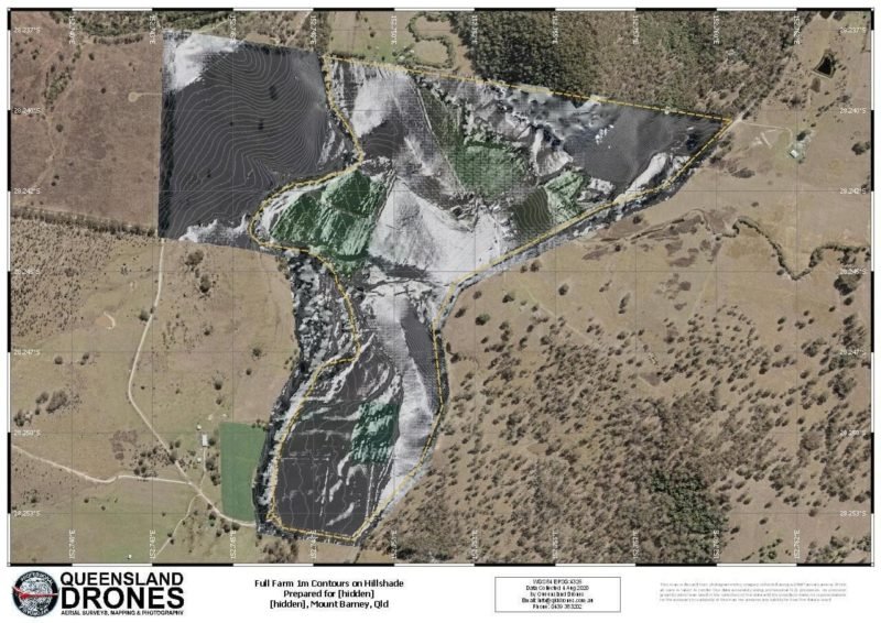
Whatever rendering is best suited to your needs, including zooming in on specific areas of the property to display much more detailed data, we can make it happen.
Contact us now on 07 3103 0566 to discuss your needs, or request a quote.
Farm Infrastructure Maps
Sometimes the biggest challenge with larger and more diverse properties, or when you’ve just bought a new property and want to make changes, is how to understand where everything is.
How do you get a complete picture of your farm infrastructure and share it with employees, casual workers, contractors and visitors? Even if you’ve owned the farm for generations, anyone new coming into the farm can struggle to understand where all those tracks go, which fields are used for which purposes, where the irrigation pipes and points are located, which tracks get boggy during heavy rain, where the sheds are located and what’s in them, etc, etc. It can be a lot to get your head around!
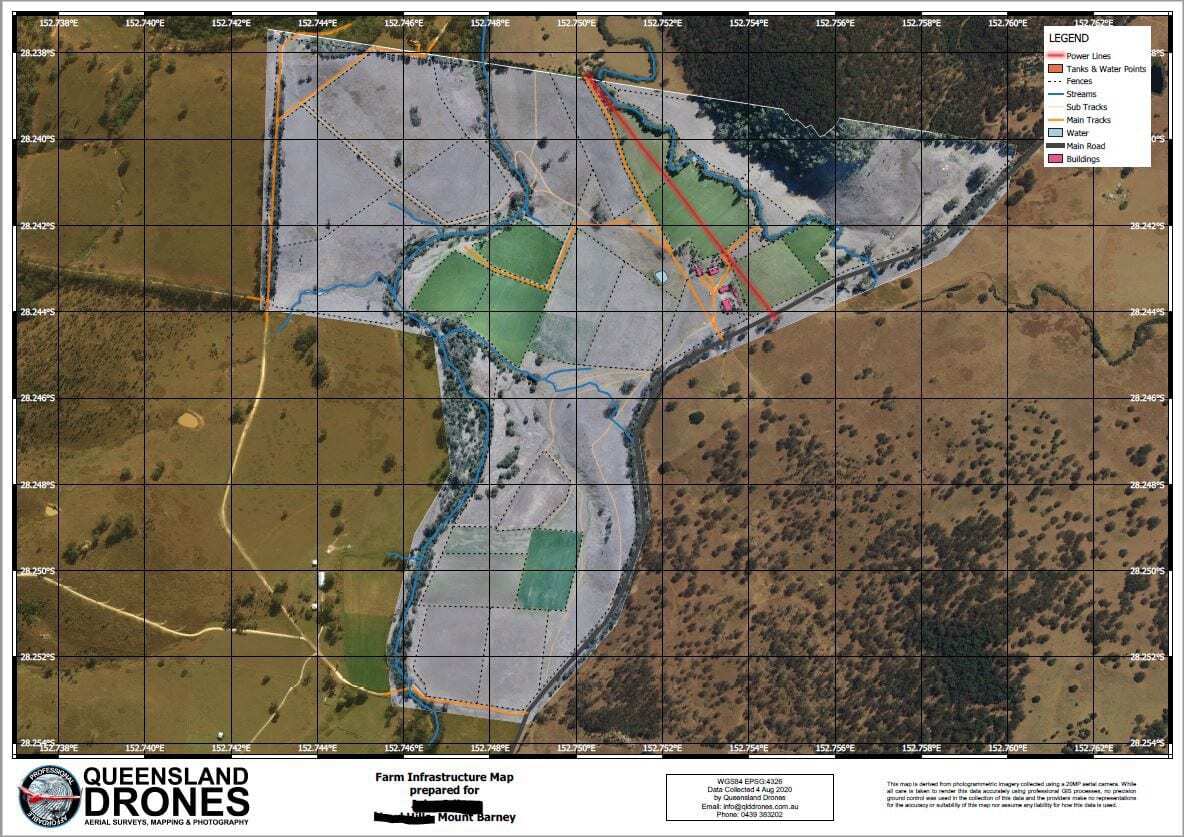
Our farm infrastructure maps make it easy to visualise every building, fence, gate, track, trough, dam and watercourse across your entire property.
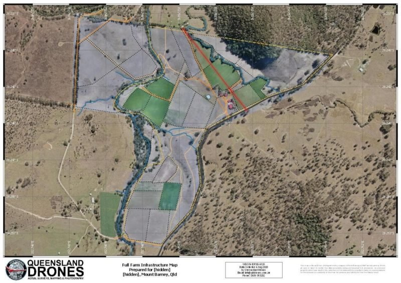
Contact us now on 07 3103 0566 to discuss your needs, or request a quote.
Other Aerial Farm Mapping Services
As well as farm photography and farm infrastructure maps, Queensland Drones can provide a range of additional farm mapping services to help you better manage your property. These include:
- Crop Health Scouting to quickly and precisely detect emerging issues like pests, diseases, water deficits and more, that may require investigation.
- Pre-Emergence Weed Mapping to detect, identify and map emergence of weeds between sowing and germination, while you can still take action.
- Post-Emergence Plant Counting to count new seedlings, verify seeding rates and identify plant gaps while you can still re-sow them.
- Pasture Quality Mapping to determine the volume and quality of pasture across your property, to inform how many cattle a pasture can support.
- Orchard Health Mapping to count trees, identify tree health issues, identify tree gaps, check ground cover health and identify emerging issues in your orchard.
- Irrigation Effectiveness Mapping to check for blocked nozzles, leaking hoses, coverage areas and variability in water distribution.
- Irrigation Planning Maps to help inform planning for new irrigation and fertigation systems, dams and silt traps.
- Field Contour Planning Maps to precisely identify the contour lines across fields and inform planting on contours, especially for tree crops.
- Precision A-B Lines to inform the installation and placement of tracks for new and relocated mobile irrigation systems.
Precision planting along the elevation contours can reduce or eliminate soil erosion and gully formation and better support the infiltration of irrigation water, fertilisers and nutrients to aid crop development. To find out more about contour planting, please take a look at Contour Farming in Encyclopedia Britannica.
Contact us now on 07 3103 0566 to discuss your needs, or request a quote.
Get in Touch about Farm Mapping Options!
Tell us about your farm mapping requirements and we will develop a proposal that meets your specific information needs to support decision-making about crop planning, field rotation, material change of use, land clearing and reforestation projects, etc.
Need detailed crop analysis and yield prediction mapping? See our Agronomic Multispectral Crop Mapping service!
Contact us now on 07 3103 0566 to discuss your needs, or complete the form below.
If you are looking for software to develop your own farm maps from satellite imagery, we suggest you visit FarmMap4D.
If you would like to know more about the process of developing a farm map, the Queensland Government has some useful information.


