Farm Terrain Mapping
Precise aerial digital terrain modelling of your property provides a sound technical basis for integrating modern farm management practices and precision agriculture technologies on your property.
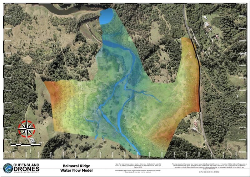
Farm terrain mapping can accurately identify contour lines for precision planting, predict how water will flow across your property and accumulate in specific areas to accurately plan new dams and inform erosion mitigation strategies. It can also assist farmers in dryer regions to develop more informed strategies for water use and management.

Captured using our 3D precision colourised Lidar system, the ground surface analysis and vegetation analysis data captured by this system can be used to:
- Optimise how you collect and store water
- Identify the best locations for creating new dams
- Predict and mitigate erosion areas
- Plan and execute contour farming activities
- Inform accurate precision agriculture system
- Plan and execute gravity-fed irrigation and fertigation
- Plan accurate A-B lines for large irrigation systems
- Build new roads and tracks along ridge lines
- Measure and visualise the vertical profile of planned and existing tracks
- Visualise terrain profile slices between any two points on your property
- Accurately identify and measure position and size of every tree on your land
- Develop detailed models of all farm infrastructure and assets
- Create induction and safety manuals for new staff on your farm
We can also assist you to identify and accurately classify all the soil and vegetation types on your property for better planning of cropping and grazing strategies and to support identification of new Category X areas that can be cleared for agriculture.
Call us now on 1300 246 977 for a free introductory discussion about how precision Lidar terrain modelling can benefit your farm or property management practices or email in**@***********om.au for more information.
