Multispectral Mapping for Crops and Vegetation
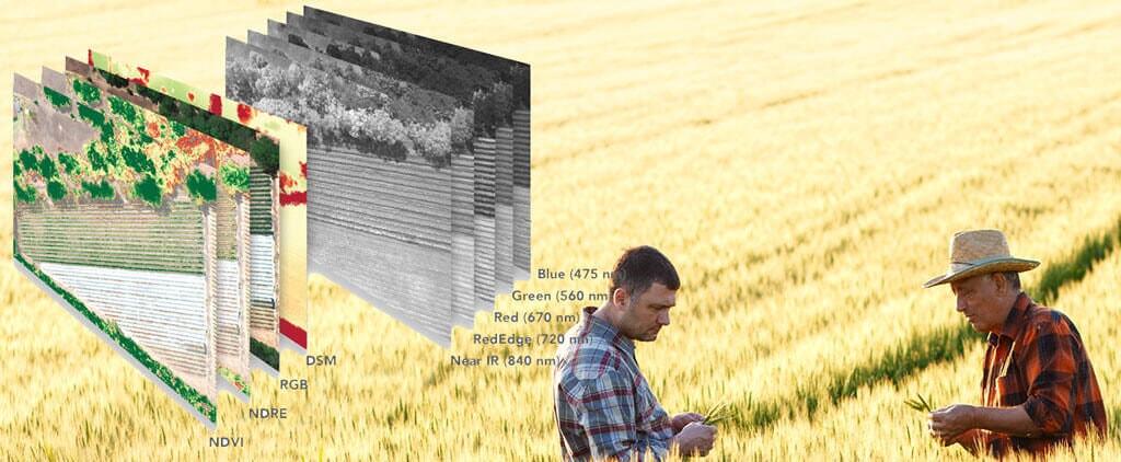
Queensland Drones provides advanced multispectral mapping of crops, orchards, infrastructure corridors and environmental management areas using Rededge multispectral sensors mounted on our multicopter, fixed wing and VTOL fixed wing UAVs. If you already know what you need, request a quote for multispectral mapping using our online form.
Multispectral mapping is not new in agriculture or environmental management. Agronomists, producers and environmentalists have been routinely using near infrared (NIR) and multispectral imagery captured by satellites like Landsat for almost 50 years to monitor broad changes in vegetation and crop health. But with a ground resolution of 30cm per pixel, even the latest Landsat 7 and Landsat 8 satellites can only deliver a broad overview result (the smallest object they can sense is the size of a rubbish bin lid), and even then the results can be of limited use due to cloud cover and other atmospheric conditions and the timing of satellite passes. During the 2019-20 bushfire season in Australia, Landsat imagery across much of the country was obscured by smoke haze for weeks at a time.
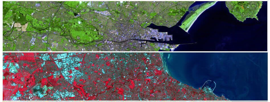
Airborne multispectral mapping data is not intended to replace satellite data, but to enhance its use through higher resolution imagery (typically 8 cm per pixel or less) that is largely not affected by smoke haze or cloud cover and can deliver data at a resolution fine enough to count and analyse plants in a field or trees in an orchard. Many of our customers come to us because they are disappointed in the limited practical applications of satellite NDVI and even traditional drone NDVI.

Request a quote for multispectral mapping
Queensland Drones is at the forefront of modern agricultural and environmental health management support, delivering precise and usable data from sensors like the Micasense Rededge M/MX and the Slantrange 4P which can capture 5 spectral bands (typically blue, green, red, red NIR and Rededge NIR) to produce extremely detailed spectral band data for expert analysis and readily usable RGB maps, chlorophyll production, weed identification, DEM/DSM and various standard crop health indexes including NDVI, OSAVI, NDRE and CIR.

Our RedEdge multispectral mapping service provides a richer and more readily usable set of crop and tree health data than traditional satellite data or even modern NIR NDVI mapping offered by many agricultural drone service providers.
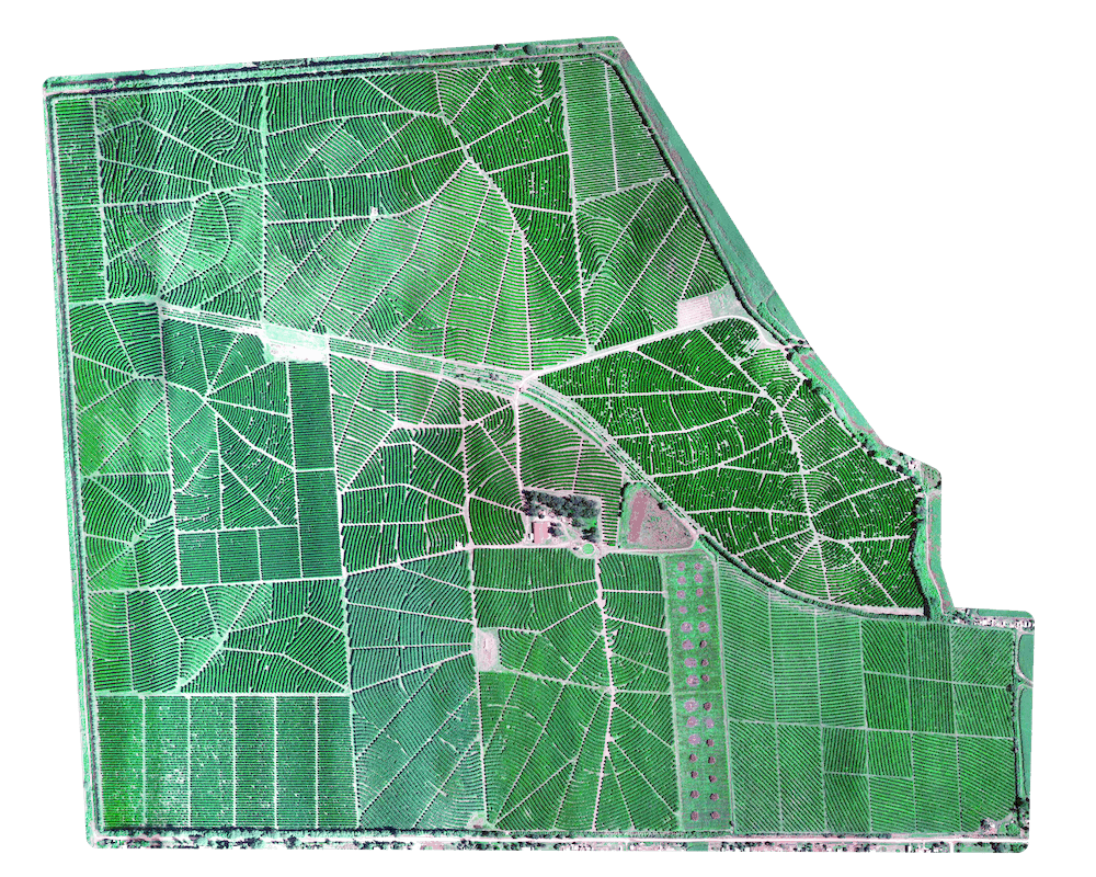
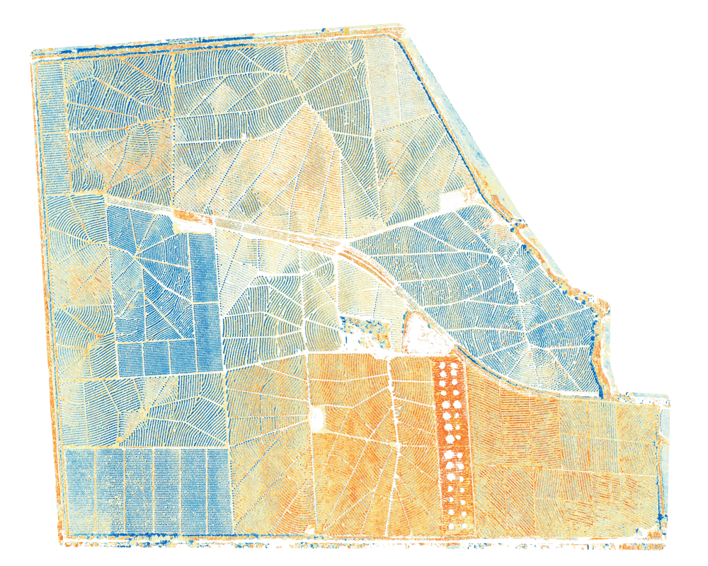
Move the slider in the image above to see a direct comparison between orthographic and multispectral image mapping. Detailed spectral analysis reporting, combined with detailed TIF maps and KMZ location maps, delivers the ultimate in advanced crop and tree health data for to support modern agronomic practices.
Our Micasense Rededge Multispectral Sensor is mounted on a hand-launched, short landing fixed wing UAV or a dual camera multicopter UAV to ensure we can operate in all environmental situations and quickly capture accurate multispectral mapping data, even over large areas. We can typically capture 250-300 acres per hour using our fixed wing aircraft depending on weather conditions.
Request a quote for multispectral mapping.
Predicting Yield Potential using Multispectral Mapping
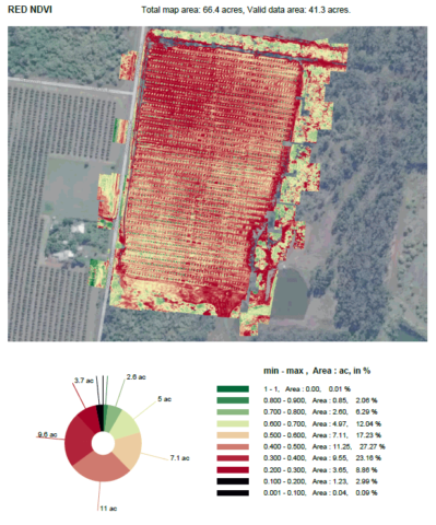
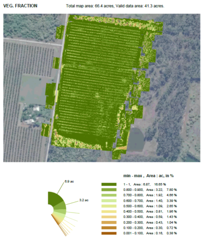
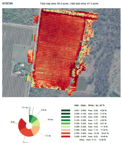
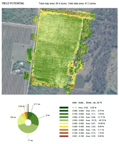
Modern multispectral mapping with sensors carried by drones (UAVs) provide the most comprehensive data ever to be made available for the assessment of potential yield and harvest readiness in a crop, especially high value crops like macadamias, avocados and mangoes. This gallery shows data to inform accurate pre-harvest analysis for a commercial avocado crop.
Our multispectral mapping service can also provide reliable data to measure water stress, irrigation effectiveness, location of drainage tiles, weeds and diseases, fungal diseases and much more.
Request a quote for multispectral mapping

